


Inversions & 3D Geophysical Models
Click to explore our way of turning data into models and visualize geoscience like never before ![]()
Inversions & 3D Geophysical Models
Click to explore our way of turning data into models and visualize geoscience like never before ![]()
EM
The EM inversion process involves the conversion of raw EM data into a 3D model of the subsurface conductivity distribution. This kind inversion is currently utilized in Nickel exploration or massive sulfides targets.
DCIP3D
DCIP 3D inversion is a valuable tool for base metal exploration producing a 3D model of resistivity and chargeability of the subsurface. Analyzing these models and integrating with geological data is it possible to determine the potential to host mineralization, detect the shape and depth of deposit and better understand the geology of the target.
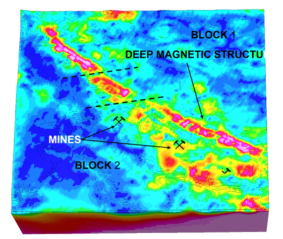
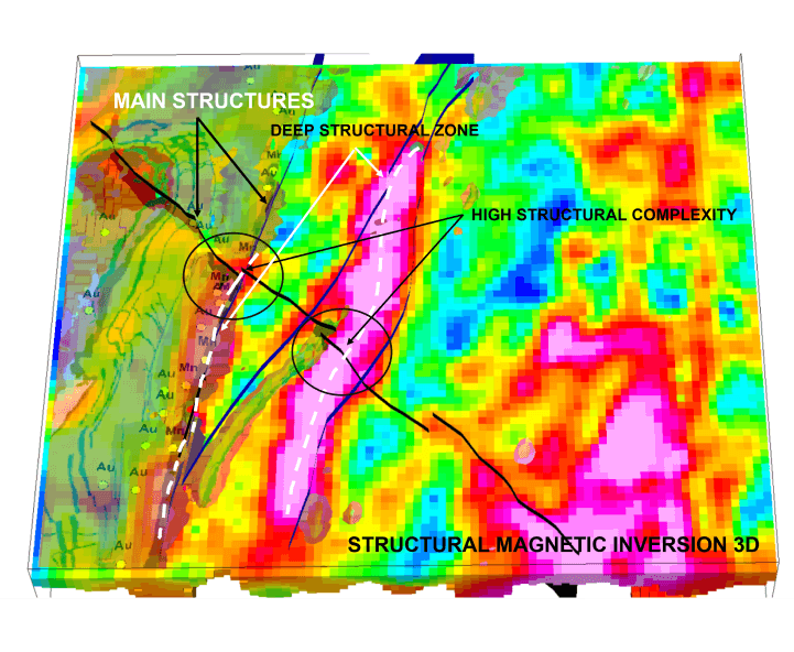
MAGNETIC DATA: MVI – Magnetic Vector Inversion AND AMPLITUDE INVERSIONS
MVI is an inversion technique that considers the vector nature of magnetic data and can help to reduce noise and increase the accuracy of the 3D models created from this data. This is particularly useful in areas with complex geology, where traditional magnetic inversion techniques may struggle to accurately represent the subsurface. This technique is particularly useful in the exploration of deposits that are associated with magnetic minerals, such as iron, base metals, kimberlites, carbonatites, and platinum group elements.
Amplitude inversion is a geophysical technique that utilizes the 3D magnetic gradient to create detailed models of the subsurface magnetic field distribution. This technique is particularly useful in the exploration of mineral deposits associated with remanent magnetization, i.e. IOCG deposits or nickel deposits with sulfide mineral or even any magnetic targets, including iron mineralization.
GRAVIMETRIC inversion
Commonly used in mineral exploration to estimate the subsurface density distribution.The results of gravimetric inversion can be used to identify potential mineral deposits. Normally base metals deposits and some kind of gols mineralization are hosted in rocks with higher density than geological background, which can mapped by density models.
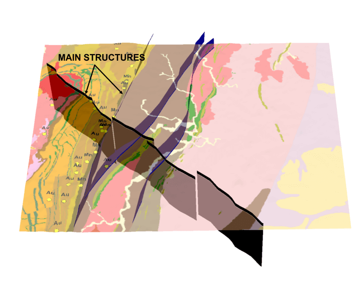
Incorporating geological or geophysical previous value information in the model we obtain the constrained 3D inversion, resulting in a more accurate and geologically plausible model of the subsurface.
Joint inversion is a technique that involves integrating multiple geophysical data sets, such as gravity, magnetic, and electromagnetic data, into a single inversion model. This approach can result in a more accurate and detailed representation of the subsurface geology by incorporating the strengths of each individual data set.
Cooperative inversion is a technique that involves combining geophysical data with geological information, such as drill hole data or geological maps. This approach can result in a more accurate representation of the geological features and structures and can be useful in areas with complex geology or limited geophysical data.
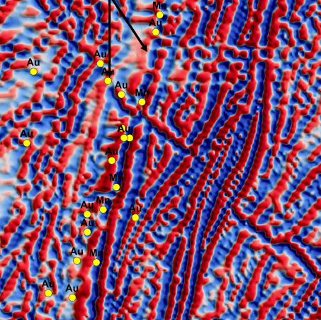
An implicit 3D model is a quick way to integrate your data and get a representation of geological structures, rock formations and mineralization
To build an implicit model, the routinely data collected in exploration program can be used:
The advantage of the implicit model is this type of tool can handle complex geometries and shapes better and is less sensitive to the presence of noise or missing data than explicit models.
The main product delivered is the geological model that can be used to predict the shape of the mineralized body (mineralization model). This important product can help in understanding the metallogenic model, in brownfield activities and in mine engineering activities (life of mine).